Наиболее интересные сайты по картографии, картам и географии в Латинской Америке:
Mapas
Recursos Regionales
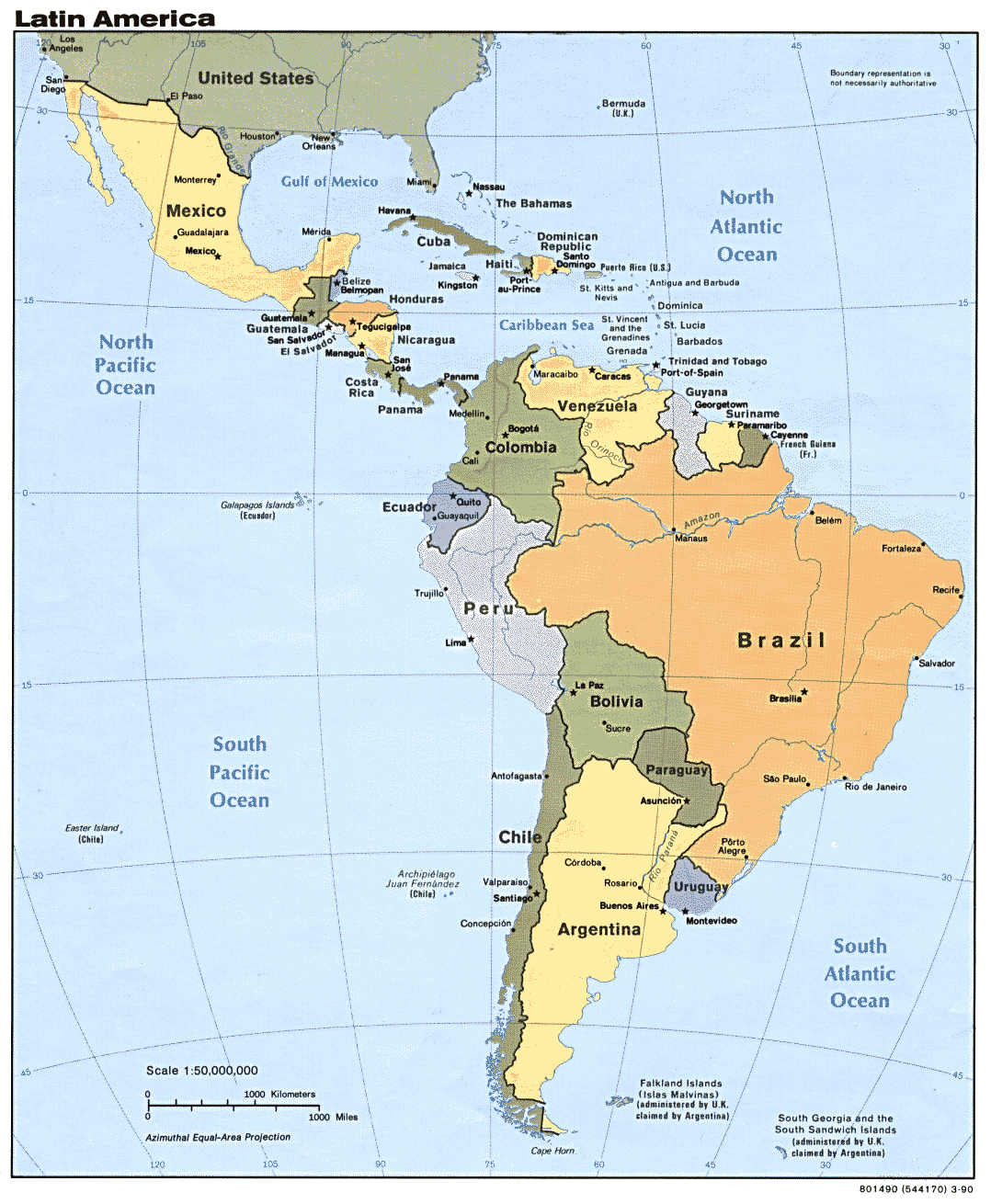
Las Américas
· The 1562 Map of the Americas by Diego Gutirrez Library of Congress
· America noviter delineata 1600s, Library of Congress
· Americae sive qvartae orbis partis nova et exactissima descriptio 1562, Library of Congress
· Antiquarian Maps of the Americas Yale Map Collection
· Carte d’Amerique dressée pour l’usage du Roy 1780, Library of Congress
· Cartes et plans de l’Amerique 1745, Library of Congress
· Central America, the West Indies South America and portions of the United States and Mexico United Fruit Company, 1909, Library of Congress
· Central/South America and the Caribbean DCW Map Interface
· Data at the Texas/Mexico Borderlands Information Center
· David Rumsey Historical Map Collection
· Early Maps from the Benson Latin American Collection The University of Texas
· Economic Commission for Latin America and the Caribbean ECLAC, PDF
· Exploring Florida Maps
· Global Spatial Data Infrastructure Latin America and Caribbean Newsletter GSDI
· Instituto Panamericano de Geografía e Historia IPGH
· Latin America Perry-Castañeda Library Map Collection, the University of Texas
· The Luso-Hispanic World in Maps Library of Congress
· Maps of the Americas Perry-Castañeda Library Map Collection, the University of Texas
· Maps of Nuclear Power Reactors: North America International Nuclear Safety Center, US Department of Energy
· New World Hargrett Rare Book & Manuscript Library, University of Georgia Libraries
· New World Maps and Site Plans Athena Review Image Archive
· Parallel Histories: Spain, the United States, & the American Frontier Library of Congress
o Selections from the LC Luso-Hispanic Map collection
· La parte orientale dell’antico e nuovo Messico con la Florida e la Bassa Luigiana dellineata sulle ultime osservazioni 1798, Library of Congress
· South & Central America & the Caribbean Green Map Places
· South & Central America Images of Early Maps on the Web, WWW Virtual Library
· Strategic map of our war with Spain 1898, Library of Congress
· The Weather Channel Español
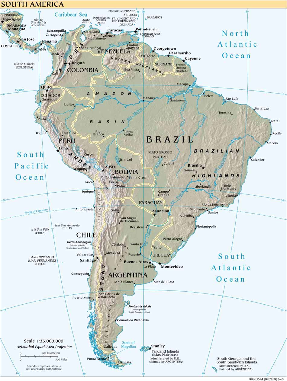
América del Sur
· Carta reducida del Estrecho de Magallanes y parte de la costa del Fuego levantado en el año de 1785 Library of Congress
· Current Seismicity for South America USGS
· Map of South America According to the Latest and Best Authorities 1826, Library of Congress
· Maps of Nuclear Power Reactors: South America International Nuclear Safety Center, US Department of Energy
· A new map of South America, shewing it’s general divisions, chief cities & towns, rivers, mountains &c. early 1700s, Library of Congress
· Plano corografico de los reconocimientos pertenecientes a la demarcacion del Art. 8o. del Trato. Preliminiar de Limites de 11 de octe. de 1777 practicados por las segundas subdivisiones española y portuguesa en orden a desatar los dudas suscitadas entre sus respectivos comisarios Library of Congress
· South America Perry-Castañeda Library Map Collection, the University of Texas
· South America Library of Congress
· South America Web Earthquakes
· South America Earthquake Map
· South America Weekly Precipitation Maps US Department of Agriculture, USDA
Disputas Territoriales
· Boundary Disputes in Latin America Jorge I. Domínguez, United States Institute of Peace, PDF
· Diferendo Guatemala/Belice Ministerio de Relaciones Exteriores, Guatemala
· Ecuador-Peru: Peace Agreements United States Institute of Peace
· International Boundaries Research Unit IBRU, University of Durham
· Limits in the Sea
· Suriname-Guyana Maritime and Territorial Disputes: A Legal and Historical Analysis Thomas W. Donovan, PDF
· Territorial Disputes and Their Resolution: The Case of Ecuador and Peru Beth A. Simmons, United States Institute of Peace
Hispanos/Latinos
· Demographic Maps: Hispanic Population CensusScope
· Maps of the Foreign Born in the United States Migration Information Source
· National Atlas of the United States
· U.S. Census Bureau Geography
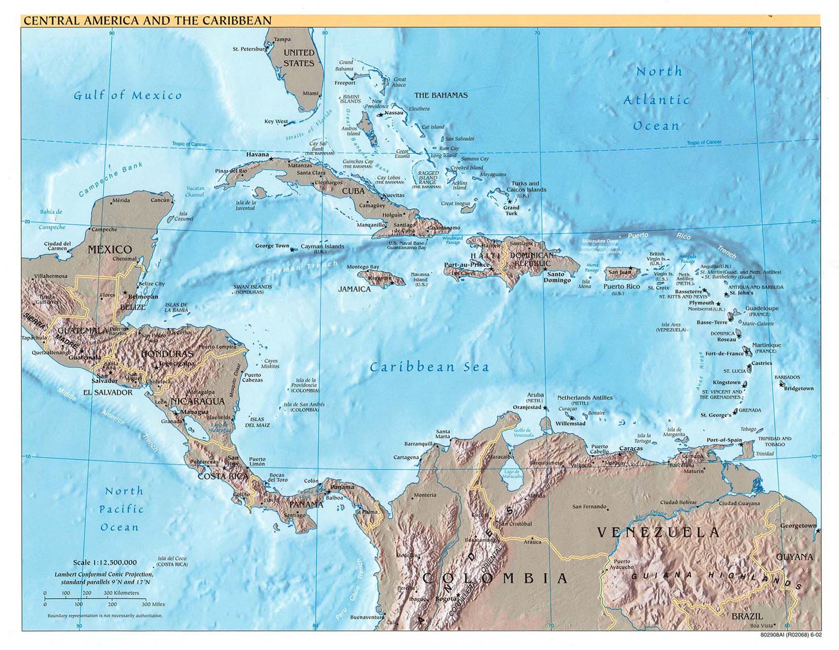
México, América Central y El Caribe
· Aztec, Olmec and Mesoamerican Maps History Link 101
· Caribbean Area Subject Search of the Online Map Collection of the Library of Congress
· Caribbean Island Directory, Vacation Tips and Road Maps Calabash Skyviews Ltd.
· Caribbean Maps Caribbean-On-Line
· Carta de los Estados de Centro-America 1862, Library of Congress
· Central America Subject Search of the Online Map Collection of the Library of Congress
· Central America and the Caribbean Library of Congress
· Central America and the Caribbean Perry-Castañeda Library Map Collection, the University of Texas
· Central America Earthquake Map Also has Mexico
· Current Seismicity for Mexico, Central America, & the Caribbean USGS
· Descripcion de la costa de Tierra Firme desde el Rio de la Empalizada hasta Cavo de Clara. Por las latitudes y longitudes de Dn. Bartolome de Rosa. Echo por Balentin Cierto primer Piloto de la Real Armada, a.o de 1757 Library of Congress
· Evening Post Map of the West Indies 1898, Library of Congress
· Hispaniola Subject Search of the Online Map Collection of the Library of Congress
· Mayan Maps History Link 101
· New Spain Subject Search of the Online Map Collection of the Library of Congress
· Nova Hispania, Nova Galicia, Gvatimala 1671, Library of Congress
· Relaciones Geográficas Collection Benson Latin American Collection, the University of Texas
· SERVIR Mesoamerican Monitoring and Visualization System
· The West Indies and the Mexican Gulf 1806, Library of Congress
Recursos por País
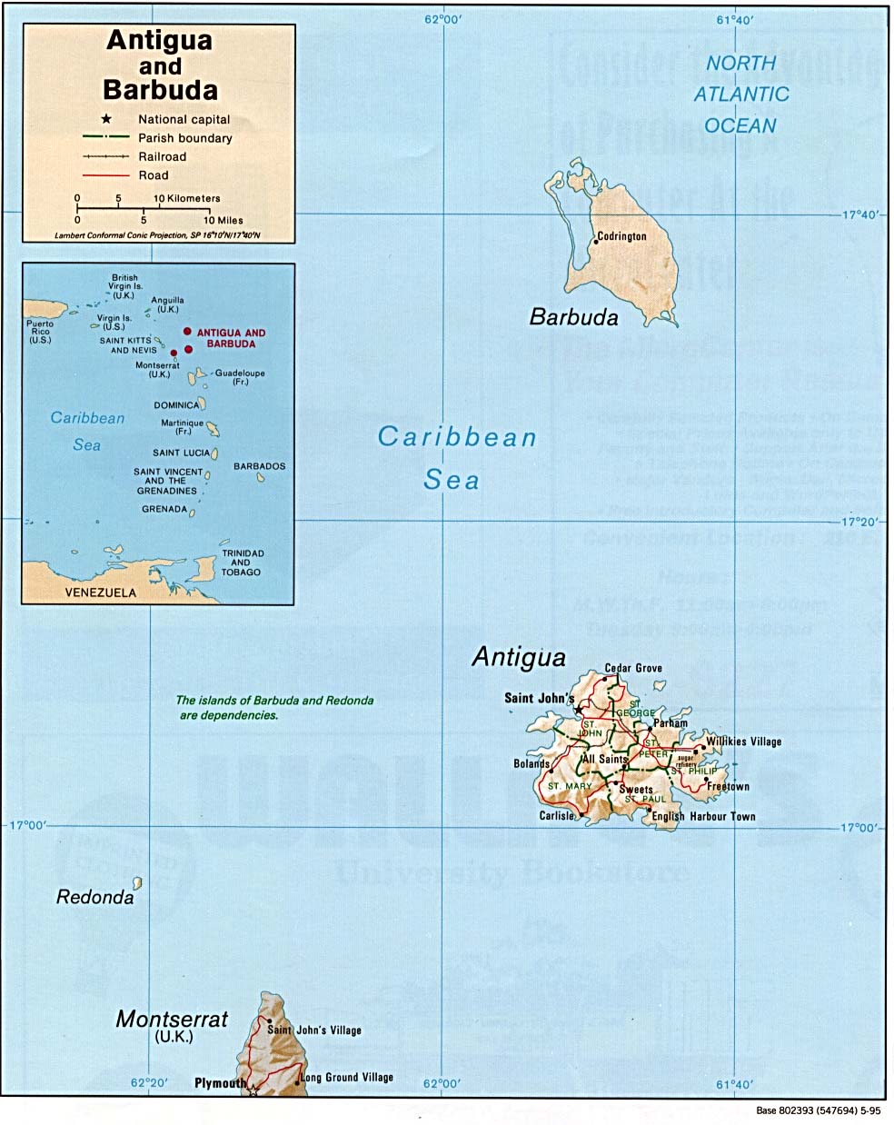
Antigua y Barbuda
· Antigua & Barbuda Caribbean-On-Line
· Antigua and Barbuda Perry-Castañeda Library Map Collection, the University of Texas
· Antigua Map Antigua and Barbuda Department of Tourism
· Antigua Map Calabash Skyviews
· A plan of English Harbour; with the King’s yard and carreening wharfe, 15th. Nov. 1745 Library of Congress
Argentina
· Argentina Lonely Planet
· Argentina Perry-Castañeda Library Map Collection, the University of Texas
· Cartografía Automóvil Club Argentino
· Cartografía de las Areas Protegidas Sistema de Información de Biodiversidad, SIB
· Cybermapa.com
· Falkland Islands Perry-Castañeda Library Map Collection, the University of Texas
· Instituto Geográfico Militar IGM
· KmxKm
· Map City
· Mapa Verde de Argentina
· Plan topografica del Valle de Centa 1794, Library of Congress
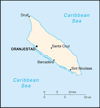
Aruba
· Aruba Caribbean-On-Line
· Aruba Lonely Planet
· Aruba Perry-Castañeda Library Map Collection, the University of Texas
· Geography/Maps of Aruba: Virtual Reality Tour Aruba.com
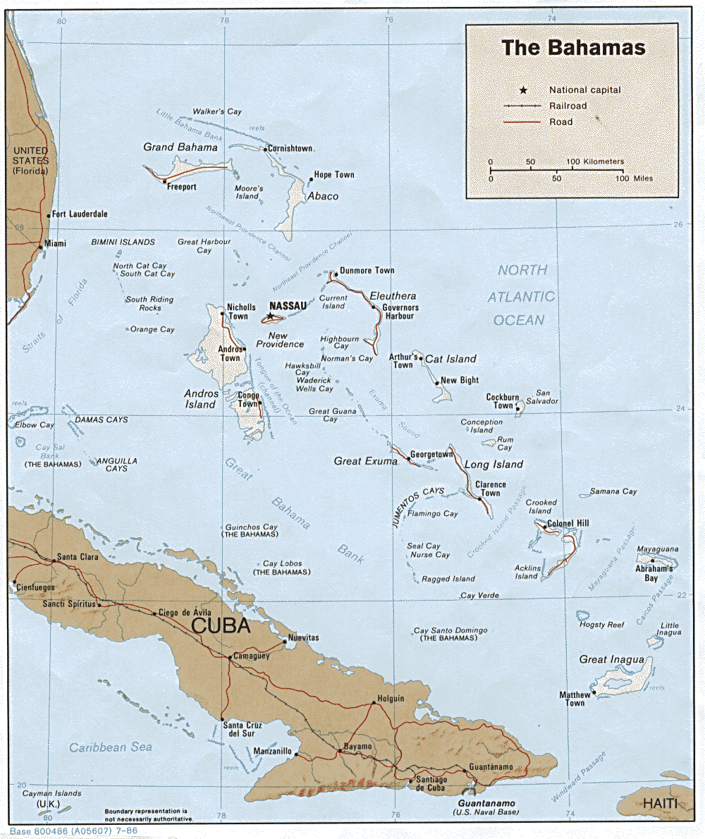
Las Bahamas
· The Bahamas Caribbean-On-Line
· The Bahamas Lonely Planet
· The Bahamas Perry-Castañeda Library Map Collection, the University of Texas
· Islands of the Bahamas Government of the Bahamas
· [Map of a part of the island of Cuba and of the Bahamas] 1600s, Library of Congress
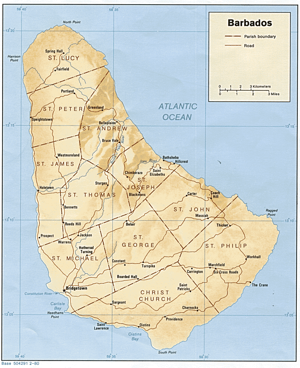
Barbados
· Barbados Caribbean-On-Line
· Barbados Lonely Planet
· Barbados Perry-Castañeda Library Map Collection, the University of Texas
· General Information Ministry of Tourism
· Points & Places of Interest Barbados Tourism Encyclopedia
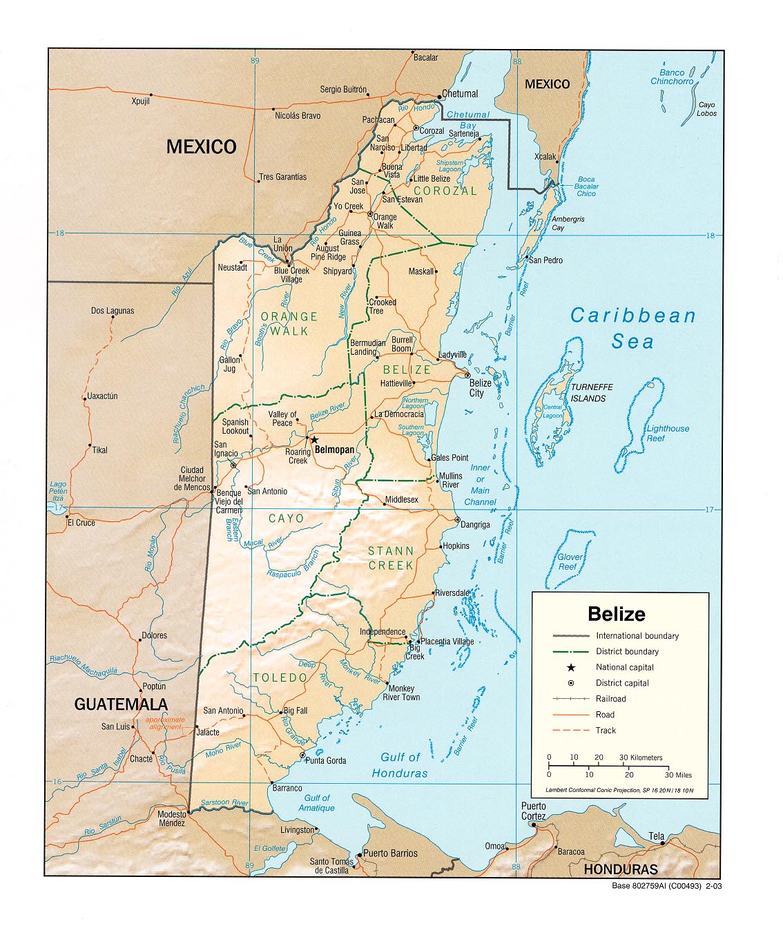
Belice
· Belize Belize.Net
· Belize Lonely Planet
· Belize Perry-Castañeda Library Map Collection, the University of Texas
· Facts and Maps for Belize & Ambergris Caye
· Geographical Research in Belize Edinburgh University
· Location & Maps Belize Tourism Board
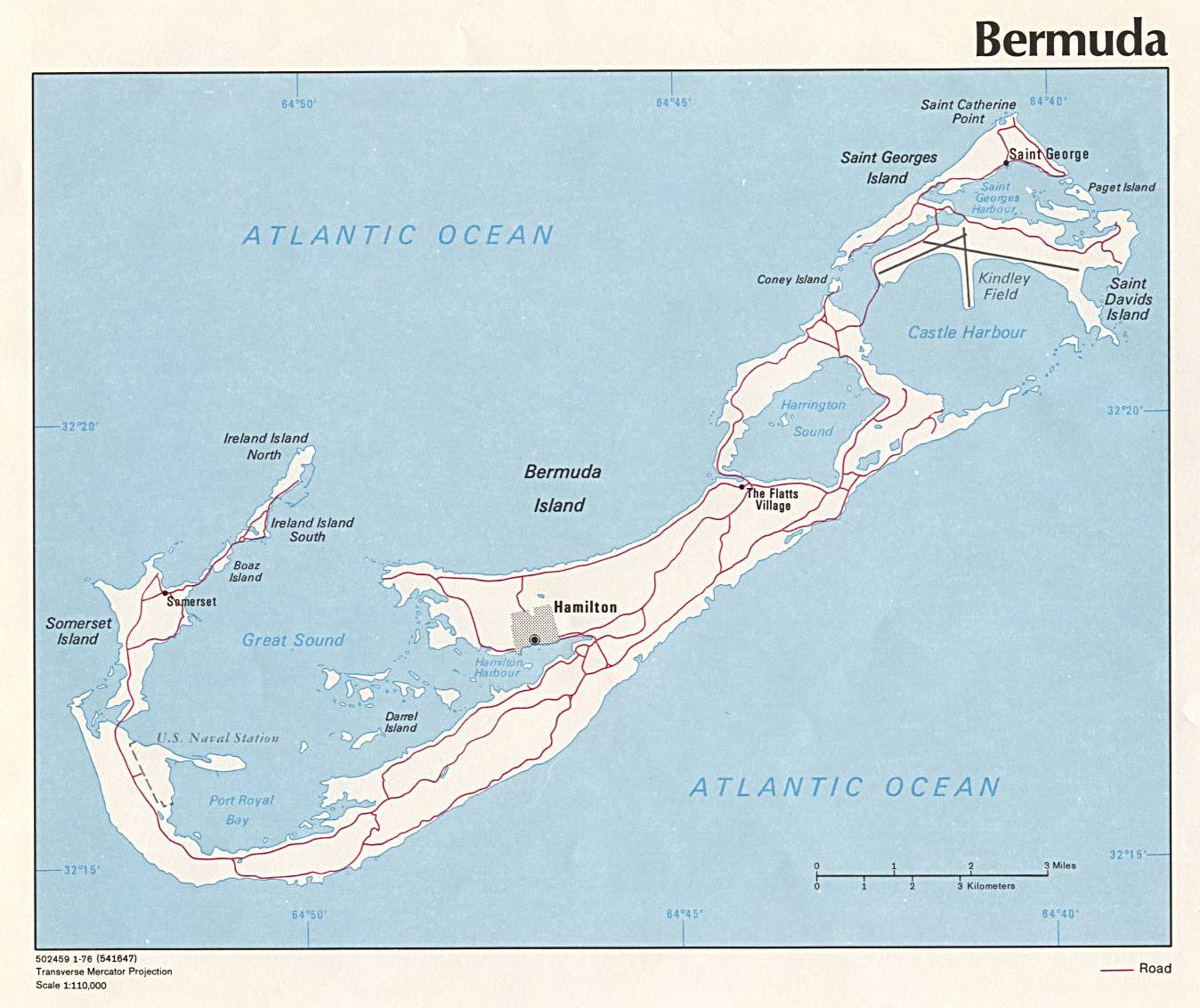
Bermuda
· Bermuda Lonely Planet
· Bermuda Perry-Castañeda Library Map Collection, the University of Texas
· Mappa Aestivarum Insularum alias Bermudas dictarum 1626, James Ford Bell Library, the University of Minnesota
Bolivia
· Bolivia Lonely Planet
· Bolivia Perry-Castañeda Library Map Collection, the University of Texas
· Bolivia United Nations, PDF
· Bolivian Maps Gallery Bolivia Web
Brasil
· Banco de Informações e Mapas de Transportes Ministério dos Transportes
· Brasil Visto do Espaço
· Brazil Perry-Castañeda Library Map Collection, the University of Texas
· Brazil Search of the Online Map Collection of the Library of Congress
· Brazil Lonely Planet
· Canal do Tempo
· Centro Integrado de Estudos em Geoprocessamentos CIEG, UFPR
· Comissões Brasileiras Demarcadoras de Limites
o Primeira PCDL
o Segunda SCDL
· Coordenação-Geral de Observação da Terra OBT
· Fator GIS
· GeoBusca
· Instituto Brasileiro de Geografia e Estatística IBGE
o Servidor de Mapas
· Libreria Editora
· Map City
· Map Link
· Mapas IGASA Geoprocessamento Ltda.
· Mapas e Rotas Brasilveículos, BB Seguro Auto
· NetMapa
· Sociedade Brasileira de Cartografia, Geodésia, Fotogrametria e Sensoriamento Remoto SBC
Chile
· Chile Lonely Planet
· Chile Perry-Castañeda Library Map Collection, the University of Texas
· Easter Island Photo Map
· Languages of Chile Ethnologue
· Map City
· Plano de la Bahía de Concepción de Chile situada la ciudad antigua . . . Library of Congress
· Sea Routes to Polynesia Thor Heyerdahl
Colombia
· Colombia Lonely Planet
· Colombia Perry-Castañeda Library Map Collection, the University of Texas
· Colombia South America Locator Map and Information World Atlas
· Instituto Geográfico Agustín Codazzi IGAC
Costa Rica
· Carte des provinces de Nicaragua et Costa Rica 1764, Library of Congress
· Costa Rica Caribbean-On-Line
· Costa Rica Costa Rica’s TravelNet
· Costa Rica Lonely Planet
· Costa Rica Moon Publications/Photo.net
· Costa Rica Perry-Castañeda Library Map Collection, the University of Texas
· Costa Rican National Parks Location Map Costa Rica Chamber of Tourism
· Maps of Costa Rica Complete Costa Rica, COCORI
· Maptak
Cuba
· Cuba Lonely Planet
· Cuba Perry-Castañeda Library Map Collection, the University of Texas
· Cuba Search of the Online Map Collection of the Library of Congress
· Cuba Mapa
Dominica
· Cuba Lonely Planet
· Cuba Perry-Castañeda Library Map Collection, the University of Texas
· Cuba Search of the Online Map Collection of the Library of Congress
· Cuba Mapa
Ecuador
· Carta de la Provincia de Quito y de sus adjacentes 1750, Library of Congress
· Ecuador Perry-Castañeda Library Map Collection, the University of Texas
· Ecuador United Nations, PDF
· Ecuador & the Galapagos Islands Lonely Planet
· Galapagos Geology on the Web
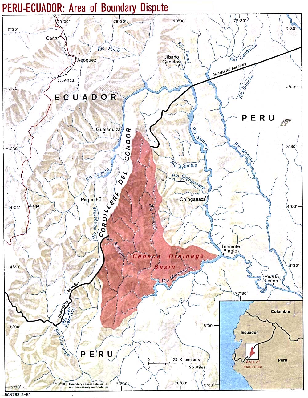
· Peru-Ecuador Area of Boundary Dispute, 1981
El Salvador
· El Salvador Lonely Planet
· El Salvador Perry-Castañeda Library Map Collection, the University of Texas
· El Salvador United Nations, PDF
· Mapa de El Salvador Ministerio de Turismo
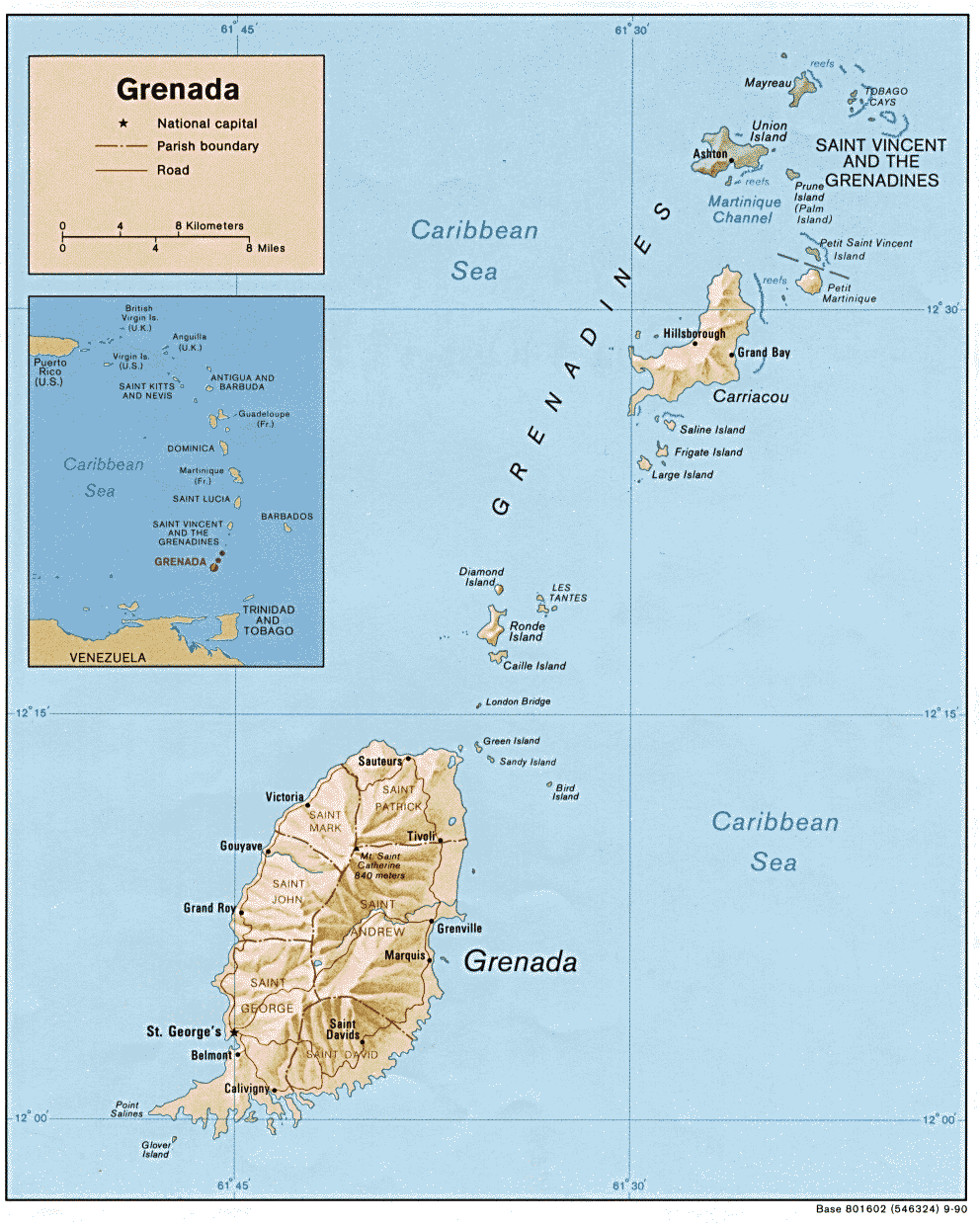
Granada
· Grenada Perry-Castañeda Library Map Collection, the University of Texas
· Grenada Road Map, Street and Town Maps Skyviews
· Plan de l’attaque et de la prise de l’isle de la Grenade le 3 juillet 1779 Library of Congress
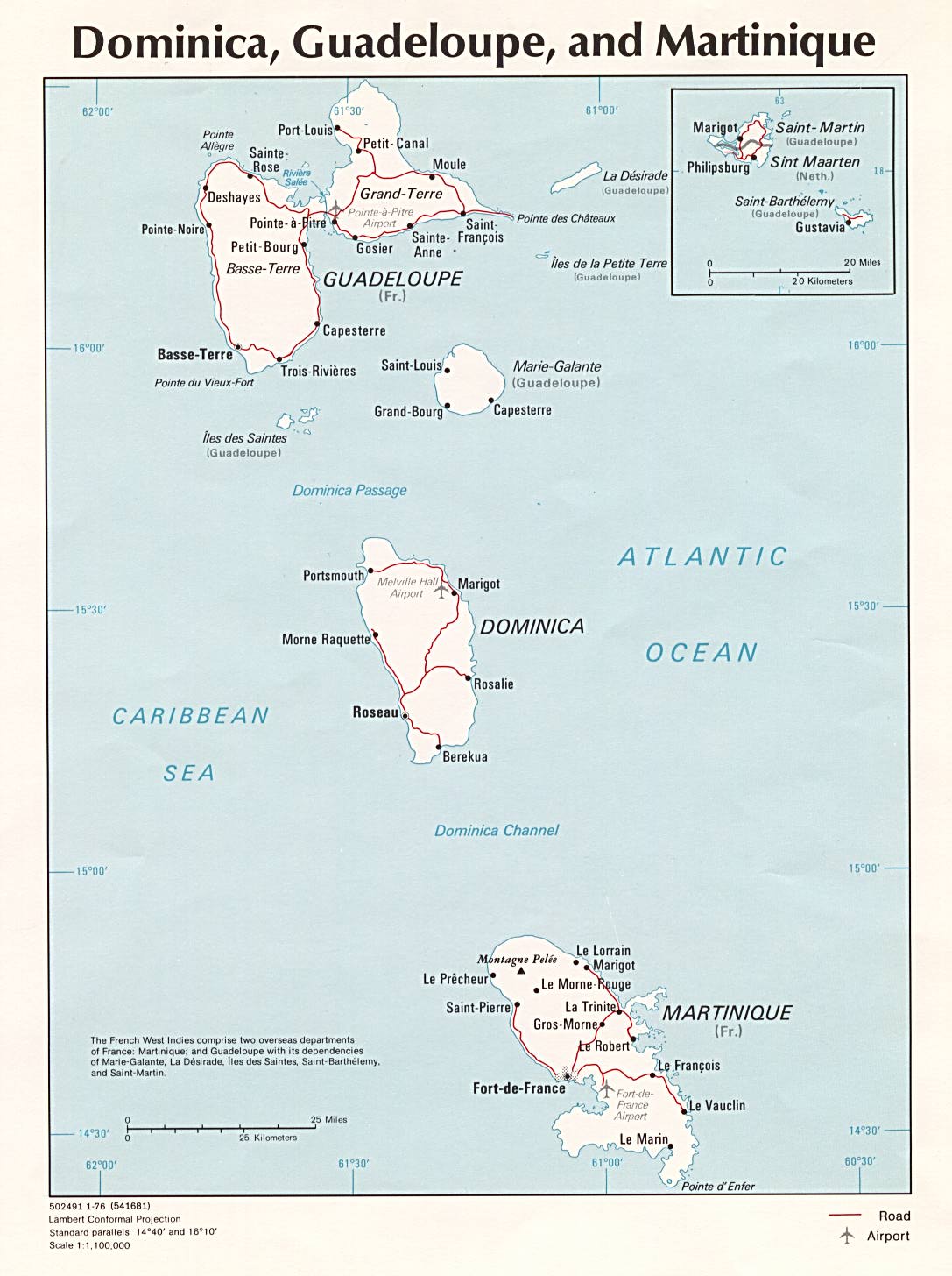
Guadalupe
· Dominica, Guadeloupe, and Martinique Perry-Castañeda Library Map Collection, the University of Texas
· A Good Look at the Island Marie-Galante Tourist Board
· Guadeloupe Lonely Planet
Guatemala
· Guatemala Lonely Planet
· Guatemala Perry-Castañeda Library Map Collection, the University of Texas
· Guatemala United Nations, PDF
· Map of Guatemala : reduced from the survey in the archives of that country, 1826 Library of Congress
· Sistema de Información Geográfica SIG
Guyana
· Graphic Map’s locator map of Guyana
· Guyana Lonely Planet
· Guyana Perry-Castañeda Library Map Collection, the University of Texas
· Map of Guyana Guyana News and Information
· Map of Guyana Turquoise Net
Guyana Francesa
· French Guiana Lonely Planet
· French Guiana Perry-Castañeda Library Map Collection, the University of Texas
Haití
· Haiti Perry-Castañeda Library Map Collection, the University of Texas
· Haiti Search of the Online Map Collection of the Library of Congress
· Haiti United Nations, PDF
Honduras
· Draught of the Bay of Honduras and the Musqueto Shoar 1764, Library of Congress
· Honduras Lonely Planet
· Honduras Perry-Castañeda Library Map Collection, the University of Texas
· Honduras United Nations, PDF
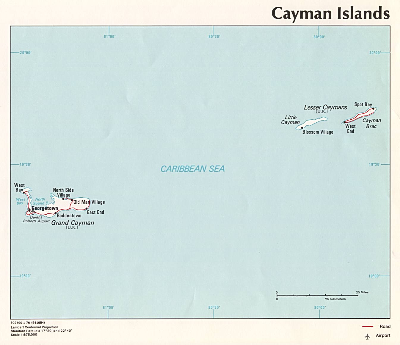
Islas Caimán
· The Cayman Islands Caribbean-On-Line
· The Cayman Islands Perry-Castañeda Library Map Collection, the University of Texas at Austin
· Maps of the Cayman Islands Cayman Islands Government
Islas Vírgenes
· Tilforladelig kort over eylandet St. Croix . . . 1754, Library of Congress
· US Virgin Islands Lonely Planet
· U.S. Virgin Islands Perry-Castañeda Library Map Collection, the University of Texas
· US Virgin Islands Topographical Maps
Jamaica
· Jamaica Caribbean-On-Line
· Jamaica Lonely Planet
· Jamaica Perry-Castañeda Library Map Collection, the University of Texas
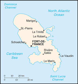
Martinica
· Cartes Comité du Tourisme de la Martinique
· Martinique Lonely Planet
· Martinique Perry-Castañeda Library Map Collection, the University of Texas
México
· Mapa Digital de México Instituto Nacional de Estadística Geografía e Informática, INEGI
· Maps of the Pimería University of Arizona Library Map Collection
· Mexico Lonely Planet
· Mexico Perry-Castañeda Library Map Collection, the University of Texas
· Mexico Subject Search of the Online Map Collection of the Library of Congress
· Mexico Weekly Precipitation Maps US Department of Agriculture, USDA
· [The Oztoticpac lands map] ca. 1540, Library of Congress
· Servicio Sismológico Nacional
· Von den newen Inseln : der Statt Themistitan in den newen Inseln gelegen/figurierung 1597, Library of Congress
Nicaragua
· Carte des provinces de Nicaragua et Costa Rica 1764, Library of Congress
· Map of the Mosquito Shore, Nicaragua, Central America 1894, Library of Congress
· Maps of Nicaragua 1965-1987: A Cartobibliography
· Nicaragua Lonely Planet
· Nicaragua Perry-Castañeda Library Map Collection, the University of Texas
· Nicaragua Subject Search of the Online Map Collection of the Library of Congress
Panamá
· Gerencia de Hidrometeorología
· Mapas Instituto Panam&entilde;o de Turismo, IPAT
· Panama Lonely Planet
· Panama Perry-Castañeda Library Map Collection, the University of Texas
Paraguay
· Paraguay Lonely Planet
· Paraguay Perry-Castañeda Library Map Collection, the University of Texas
· Paraguay United Nations, PDF
· Typus geographicus, Chili a Paraguay Feti Magellanici &c. 1733, Library of Congress
Perú
· Instituto Geográfico Nacional IGN
· Peru Perry-Castañeda Library Map Collection, the University of Texas
· Peru Subject Search of the Online Map Collection of the Library of Congress
· Peru-Ecuador Area of Boundary Dispute, 1981
· Peru Maps
Puerto Rico
· Mapa de Carreteras Departamento de Transportación y Obras Públicas, DTOP
· Puerto Rico Lonely Planet
· Puerto Rico Perry-Castañeda Library Map Collection, the University of Texas
· Puerto Rico Subject Search of the Online Map Collection of the Library of Congress
· Puerto Rico Perspectives Library of Congress
· Topographic Map of the Island of Vieques Library of Congress
República Dominicana
· Dominican Republic Caribbean-On-Line
· Dominican Republic Lonely Planet
· Dominican Republic Perry-Castañeda Library Map Collection, the University of Texas
· Dominican Republic–Santo Domingo Search of the Online Map Collection of the Library of Congress
· Plan de projet pour l’etablissement de la ville du Port Napoléon dans l’Isle Saint Domingue sur la presqu’isle et Baye de Samana 1807?, Library of Congress
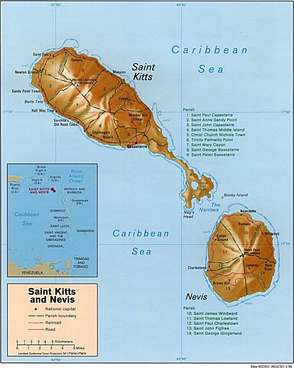
San Cristóbal y Nieves
· Island Map St. Kitts Tourism Authority
· St. Kitts & Nevis Caribbean-On-Line
· Saint Kitts and Nevis Lonely Planet
· Saint Kitts and Nevis Perry-Castañeda Library Map Collection, the University of Texas
· St. Kitts Roadmap Calabash Skyviews
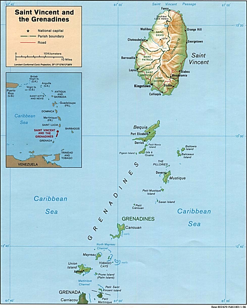
San Vicente y las Granadinas
· The Grenadines West Indies On Line
· Interactive Map Ministry of Tourism and Culture
· Map of St. Vincent West Indies On Line
· St. Vincent & the Grenadines Lonely Planet
· Saint Vincent and the Grenadines Shaded Relief, Perry-Castañeda Library Map Collection, the University of Texas
Santa Lucía
· Interactive Tour St. Lucia Tourist Board
· Saint Lucia Caribbean-On-Line
· Saint Lucia Perry-Castañeda Library Map Collection, the University of Texas
· St. Lucia Road Map, Street and Town Maps Calabash Skyviews
Suriname
· Extrait de la carte hollandise representant la colonie de Surinam 1777, Library of Congress
· Kaart Suriname
· Suriname Lonely Planet
· Suriname Perry-Castañeda Library Map Collection, the University of Texas
· Suriname South America Locator Map and Information Page
Trinidad y Tobago
· Trinidad & Tobago Caribbean-On-Line
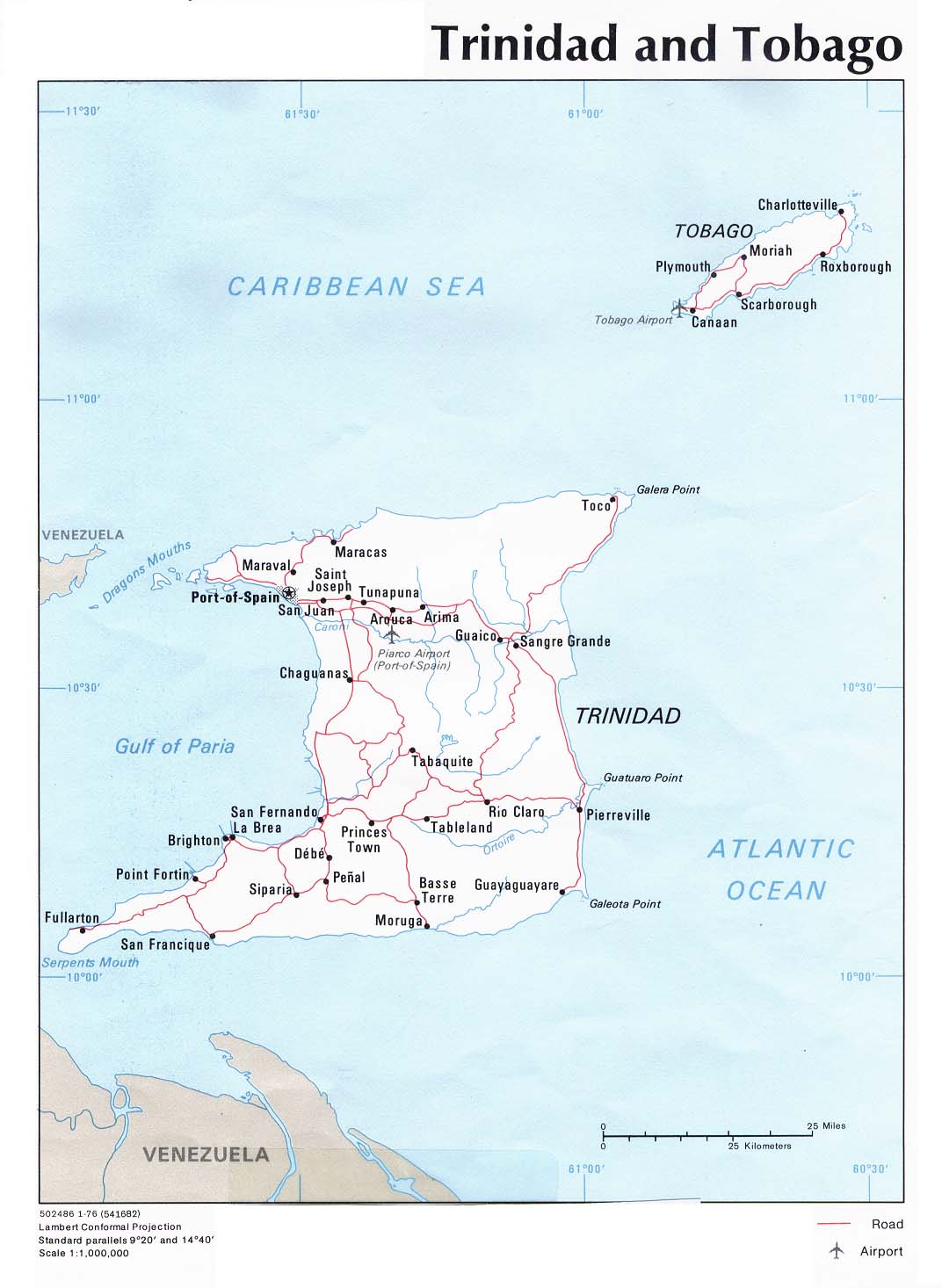
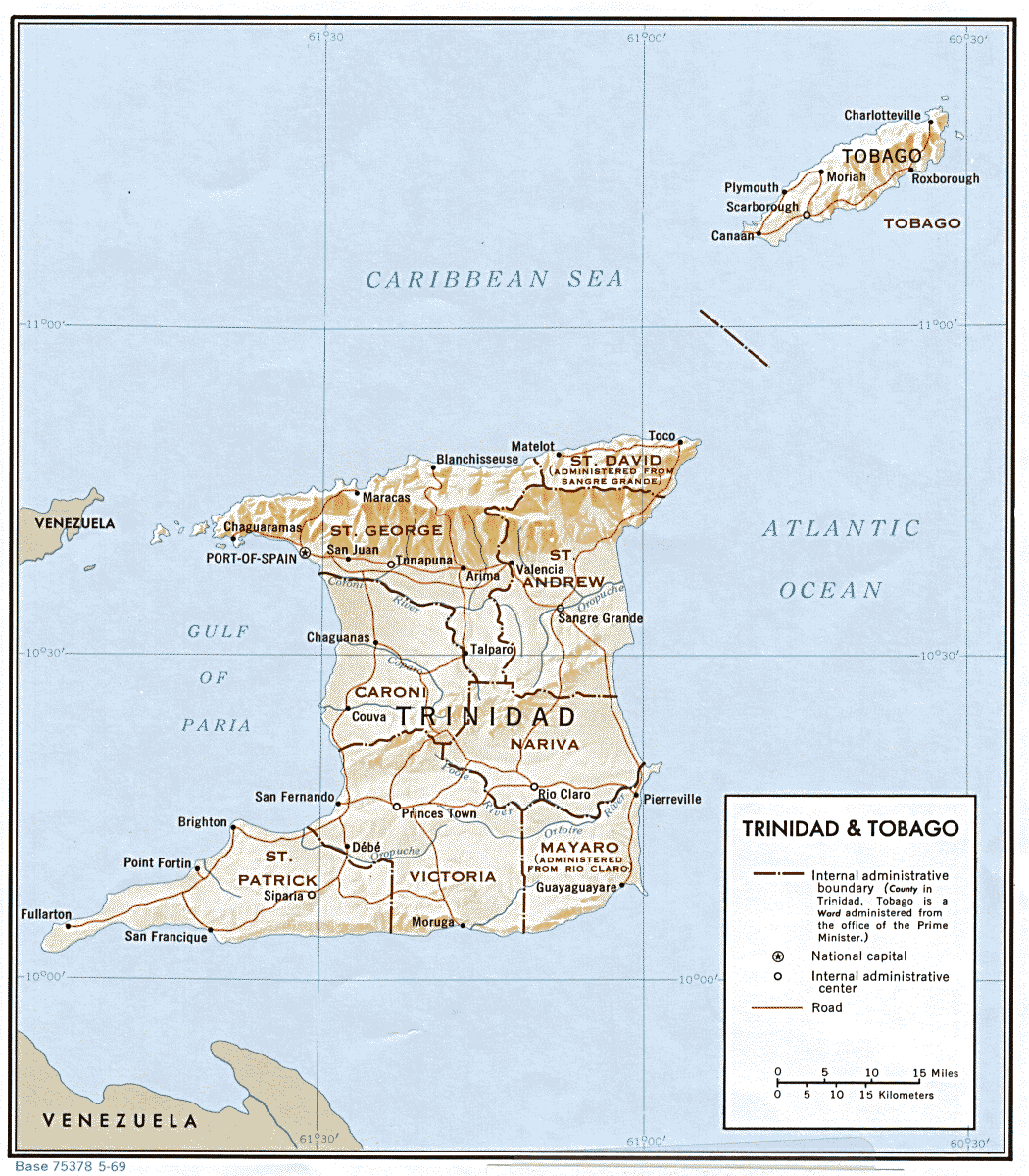
· Trinidad and Tobago Political, Perry-Castañeda Library Map Collection, the University of Texas
· Trinidad & Tobago Shaded Relief, Perry-Castañeda Library Map Collection, the University of Texas
Uruguay
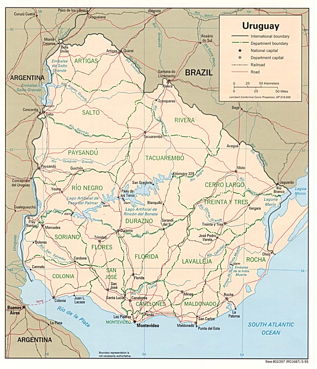
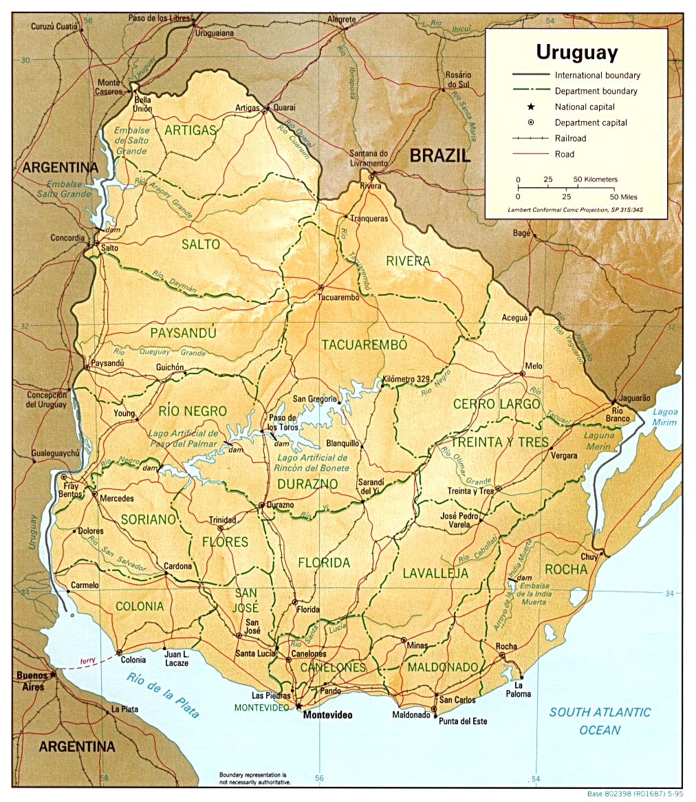
· Mapas Dirección Nacional de Minería y Geología, DINAMIGE
· Uruguay Political, Perry-Casta�� Library Map Collection, the University of Texas
· Uruguay Shaded Relief, Perry-Casta�� Library Map Collection, the University of Texas
Venezuela
· Instituto Geográfico de Venezuela Simón Bolívar IGVSB
· Mapa de los Roques
· Mapa de Venezuela Venezuela Tuya
· Mapas de Venezuela BestRentals
· Mapas de Venezuela en .pdf a-venezuela
· Venezuela Lonely Planet
· Venezuela Perry-Castañeda Library Map Collection, the University of Texas
· Venezuela Subject Search of the Online Map Collection of the Library of Congress
· Venezuela, cum parte Auftrali Novae Andalausiae 1630, Library of Congress
· Venezuela Relief Map
Recursos Internacionales
Recursos Generales
· Asociación de Geógrafos Españoles AGE
· Atlapedia Online
· Atlas of the Biosphere
· An Atlas of Cyberspaces
· British Cartographic Society B.C.S.
· Charting & Navigation National Oceanic and Atmospheric Administration, NOAA
· CIA World Factbook
· Cornell’s Digital Earth
· David Rumsey Map Collection
· Earth Sciences & Map Library UC Berkeley
· Getty Thesaurus of Geographic Names TGN
· Glossary of Cartographic Terms Perry-Castañeda Library Map Collection, the University of Texas
· Green Map System
· Gridded Population of the World GPW
· Historical Atlas of the Twentieth Century
· Humboldt State University Cartographic Society HSU
· International Association of Geodesy IAG
· John R. Borchert Map Library University of Minnesota
· Library of Congress
o Geography and Map Division G & M
o Library of Congress Hispanic and Portuguese Collections: An Illustrated Guide
o The Luso-Hispanic World in Maps
o Map Collection American Memory Project Historical Collections for the National Digital Library
· Lonely Planet Destinations
· Map Machine National Geographic
· MapQuest
· El Mundo Holt, Rinehart and Winston
· National Geospatial-Intelligence Agency NGA
· National Oceanic and Atmospheric Administration NOAA
· Quick Maps of the World
· Royal Geographical Society with the Institute of British Geographers, United Kingdom
· This Dynamic Planet U.S. Geological Survey, USGS
· United Nations Cartographic Section
· United States Geological Survey USGS
· Web Fire Mapper University of Maryland
· The World Holt, Rinehart and Winston
· World Atlas and World Maps
· World Atlas Library of Maps Flags and Geography Facts Graphic Map
Buscadores, Directorios y Portales
· Directory of Map Sites on the WWW from the Perry-Castañeda Library Map Collection of the University of Texas
· FreeGIS Project
· Geo-Guide Göttingen State and University Library
· Geography Departments Worldwide
· Geomatics Google Web Directory
· Geospatial Resources Humboldt State University Library
· GIS and Cartography Social Science Information Gateway
· GIS and Mapping Related Sites
· The GIS Portal Geographic Information Systems
· Global Positioning System Resources GPS, Sam Wormley
· Map History / History of Cartography WWW Virtual Library
· Maps Open Directory
· Oddens’s Bookmarks The Fascinating World of Maps and Mapping
· Political Geography Paul R. Hensel